Precise Point Positioning (PPP) is a sophisticated technique used
in satellite-based positioning systems, such as GNSS, to determine a
single location with high accuracy, with the help of Global Network
of Reference Stations.
Global Network of Reference Stations:
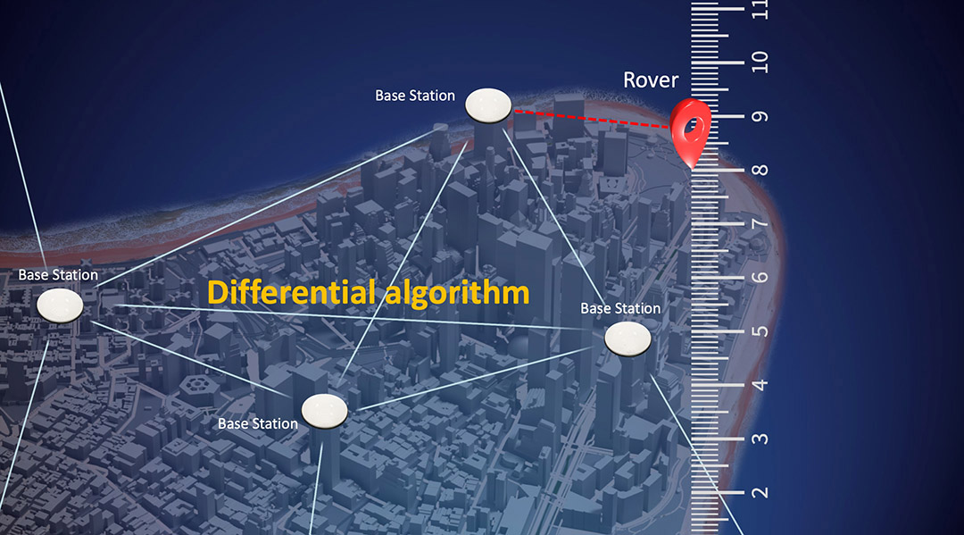
While PPP doesn't require a local
base station as RTK does, it benefits from a global network of
permanent reference stations. These stations continuously observe
satellite signals and contribute to the generation of precise
satellite products.
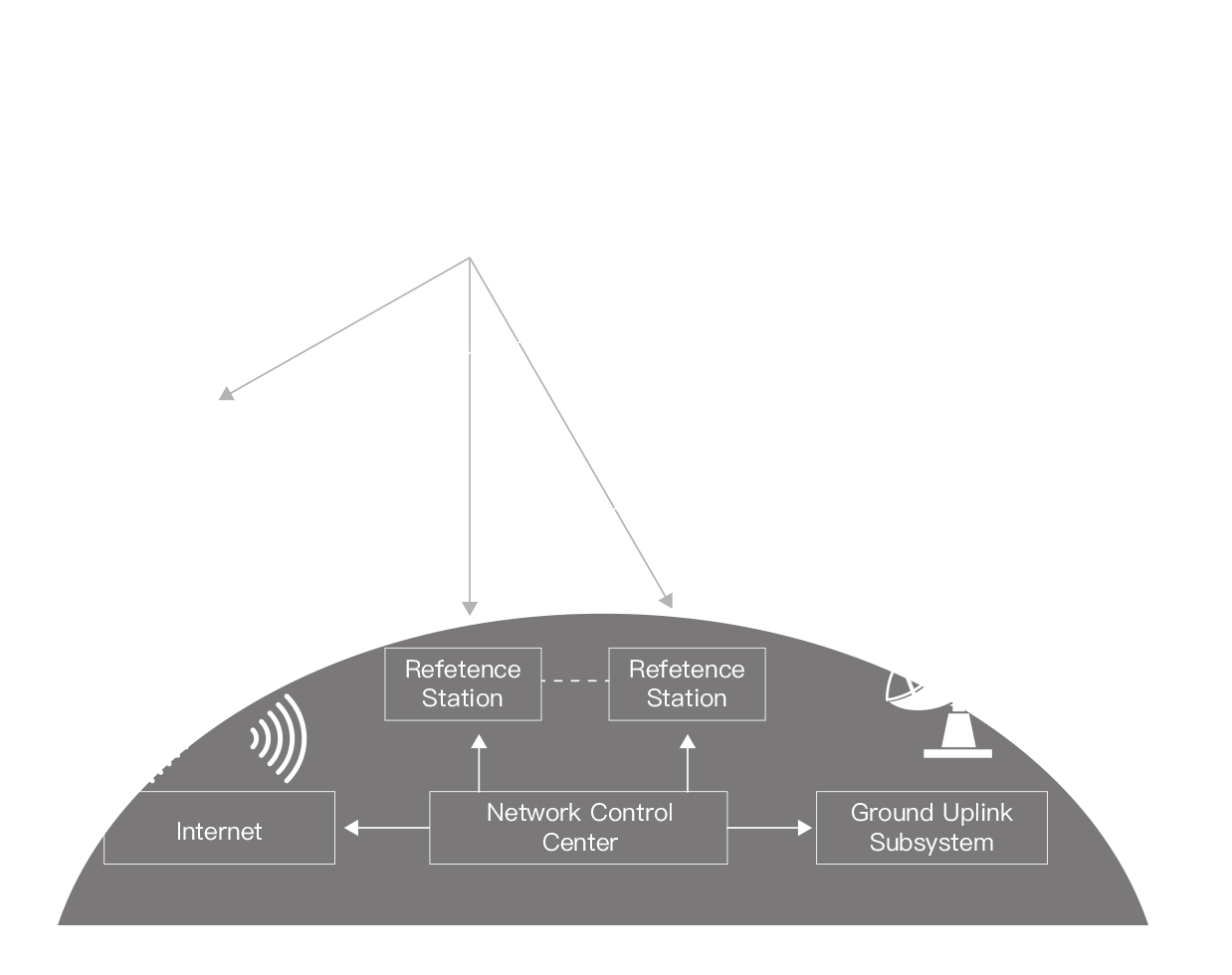
Precise Satellite Products:
Data from the network of reference stations
is used to generate precise satellite orbit and clock corrections.
These corrections are crucial for PPP's high accuracy. Along with
orbit and clock data, other parameters like satellite antenna phase
center offsets and variations, and Earth rotation parameters might
be provided.
 User Receiver (PPP Rover):
The user's PPP-enabled receiver obtains
satellite signals like any standard GNSS receiver. Simultaneously,
it retrieves the precise satellite products, either by downloading
them from a data service (in near-real-time or post-processing
applications) or receiving them through satellite broadcasts
(real-time PPP).
Correction Application:
The user's receiver applies the precise satellite
corrections to the raw satellite measurements it's taking. By doing
so, it compensates for the satellite orbit and clock errors, which
are significant error sources in GNSS positioning. Additionally,
advanced models within the PPP algorithms help correct for other
errors, such as those from the ionosphere and troposphere.
Positioning:
With the
corrected measurements, the PPP solution can compute a position
with high accuracy. However, achieving the highest levels of
accuracy with PPP can take a longer time (often called "convergence
time") compared to differential methods like RTK.